[This blog post is a repost of http://blog.atos.net/sc/2011/12/21/do-you-understand-the-world/]
Real estate brokers already know this for years; the most important aspect of their profession is location, location and location.
Given the recent boom in providing maps to mobile phones, this aspect of our lives is not just important for real estate brokers anymore. Anybody with a decent smart phone has access to a variety of mapping material, aiding in navigation and, through the addition of a GPS-receiver, location based services.
The impact of this capability to use digital maps is described in a whitepaper by the Atos Scientific Community, which states:

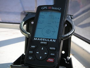
Magellan Blazer12 GPS Receiver. (Photo credit: Wikipedia)
“For centuries, humankind has devoted efforts to cartography (map making) as a means to represent the Earth in order to achieve a better understanding of the world and to solve practical problems (navigation, exploration, planning). The advent of electronic computers and peripheral devices caused another revolution in cartography during the 20th century. However, until the late 1990’s geo-information did not take a pervasive step into other fields. In the 2000’s, geo-information has become popular and is widely used by billions of people around the world for everyday purposes: we look for directions, plan our holidays or check the evolution of news events with the support of geo-information."
And while we are all just getting accustomed to this digitally enhanced 2D world, a new way of looking at this information is emerging: 3D location based services.
Using complex mathematics and new type of sensors, we will be able to enrich our flat maps with depth, height and rotation. This opportunity opens a new dimension (pun intended) in the way we can use the digital maps for more purposes than just finding our way home.
Applications in building-management, tsunami warning systems, climate and weather control as well as looking at relations between human wellbeing and location based data (such as pollution), are now in use.
The new elements coming because of 3D are emerging, so we can track people in buildings, assets in datacenters and generally combine information to create meaningful relationships in data visualization.
Tracing and combining data in 3 dimensions is not only more accurate, it also give more insight in relationships between the subjects. Only now that we are getting more insight in the associated math and have the (real-time)processing capability to calculate complex equations, we are getting insight in the correlations and how they help us interpret the real word around us.
The paper describes multiple examples and explains how the extra info can be expected to enrich our way of using the extra information for location based data.
The key is to connect the available 3D information to this extra information. This combination not only will enrich our lives, but also opens a new business opportunity for information brokers to provide and combine data that without this technology would possibly be meaningless by itself. In order for this additional data to be completely integrated in our daily lives we certainly need more study and technical breakthroughs. Most of this is done in the background, but some research and results are needed in understanding the way that people interpret 3D information.
Google Earth and other similar technology is showing me nice pictures, but does it provide extra value in 3D (on a flat screen…)?
In the end the 3D element will, certainly, greatly influence the way we interact with our world and our understanding how things relate to each other. Understanding relationships, in my opinion, always makes us a better human.
That combined with the new business opportunities, drives both personal and economic growth, so I consider this a good thing.
The Atos whitepaper can be downloaded here.


